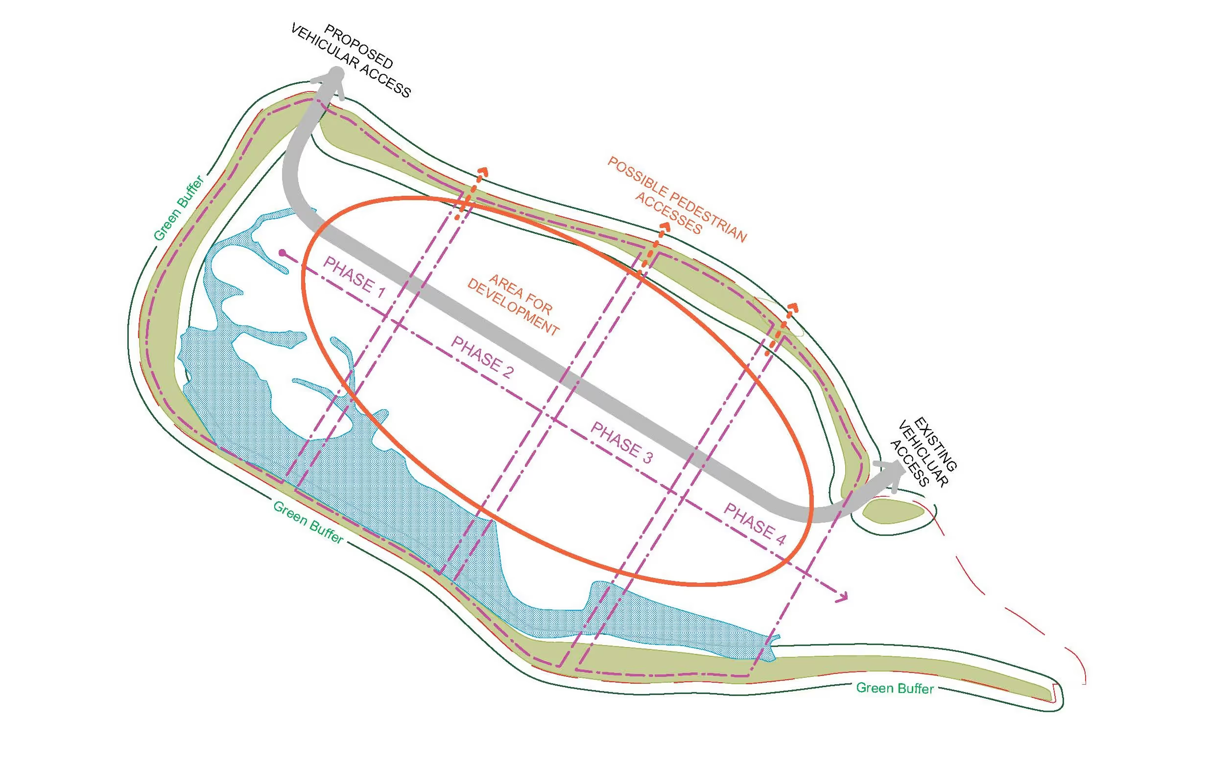
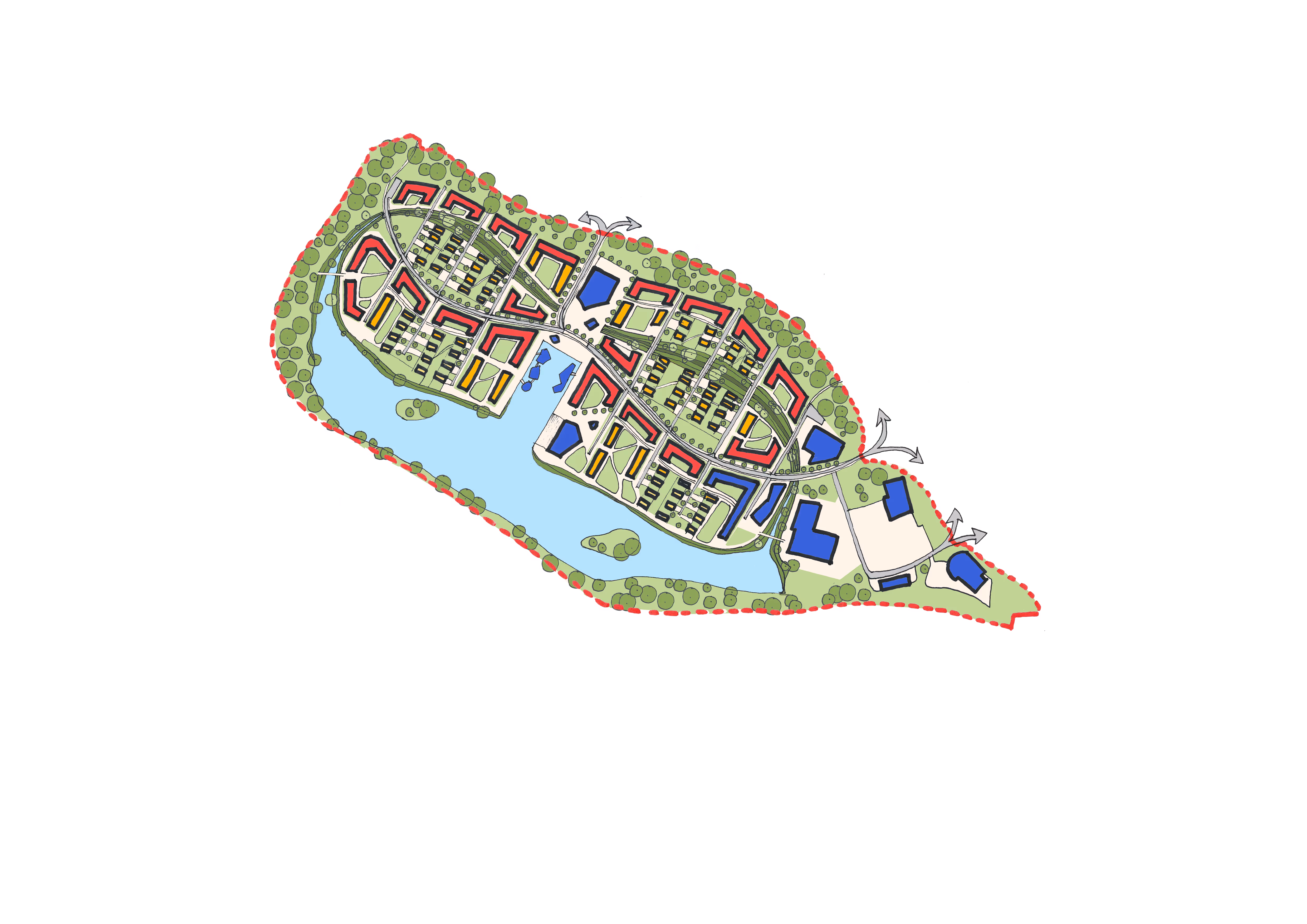
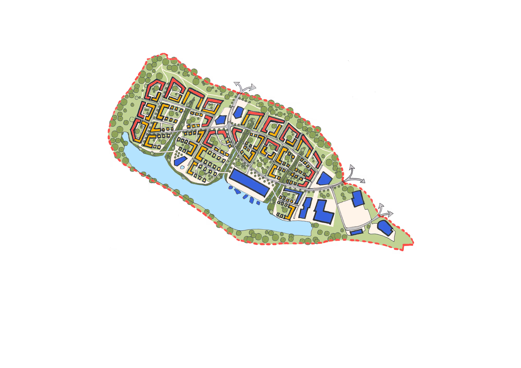
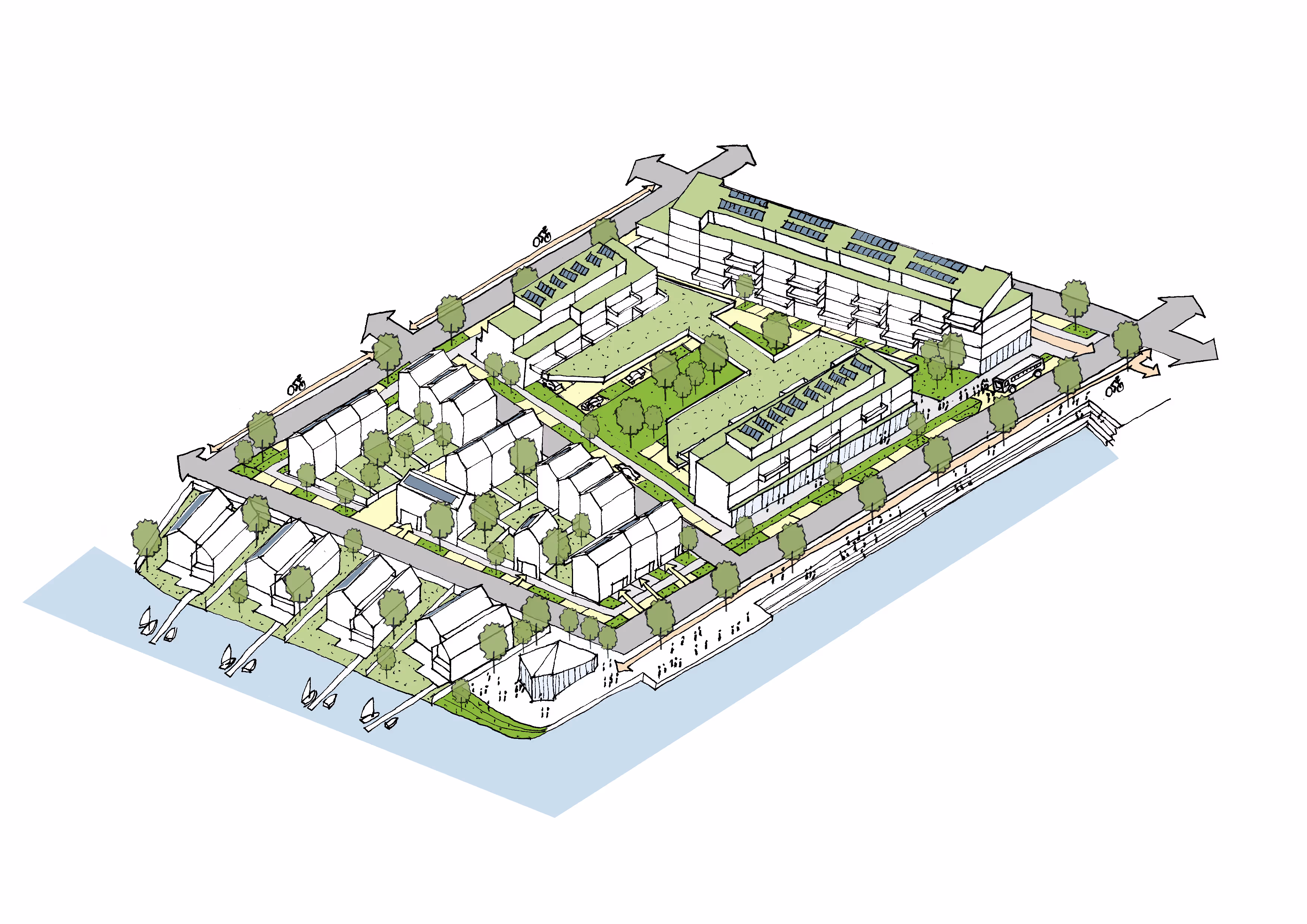
Aerial view of a modern coastal urban development with lakes, green spaces, residential buildings, and roads.

Portsmouth Waterside Masterplan

Location: Portsmouth, UK
Status: Planning Feasibility Study
Scale: circa 2,500 homes, 50ha
Constraints: Flood Zones 2 and 3, Esturine Site, Brownfield Site
Design Team:
BACA architects

World map in blue with country borders and an orange location marker on the southern coast of England, near Portsmouth.
Aerial view of a lakeside complex with several buildings, surrounding parking lots, green fields, and intersecting highways nearby.

Background

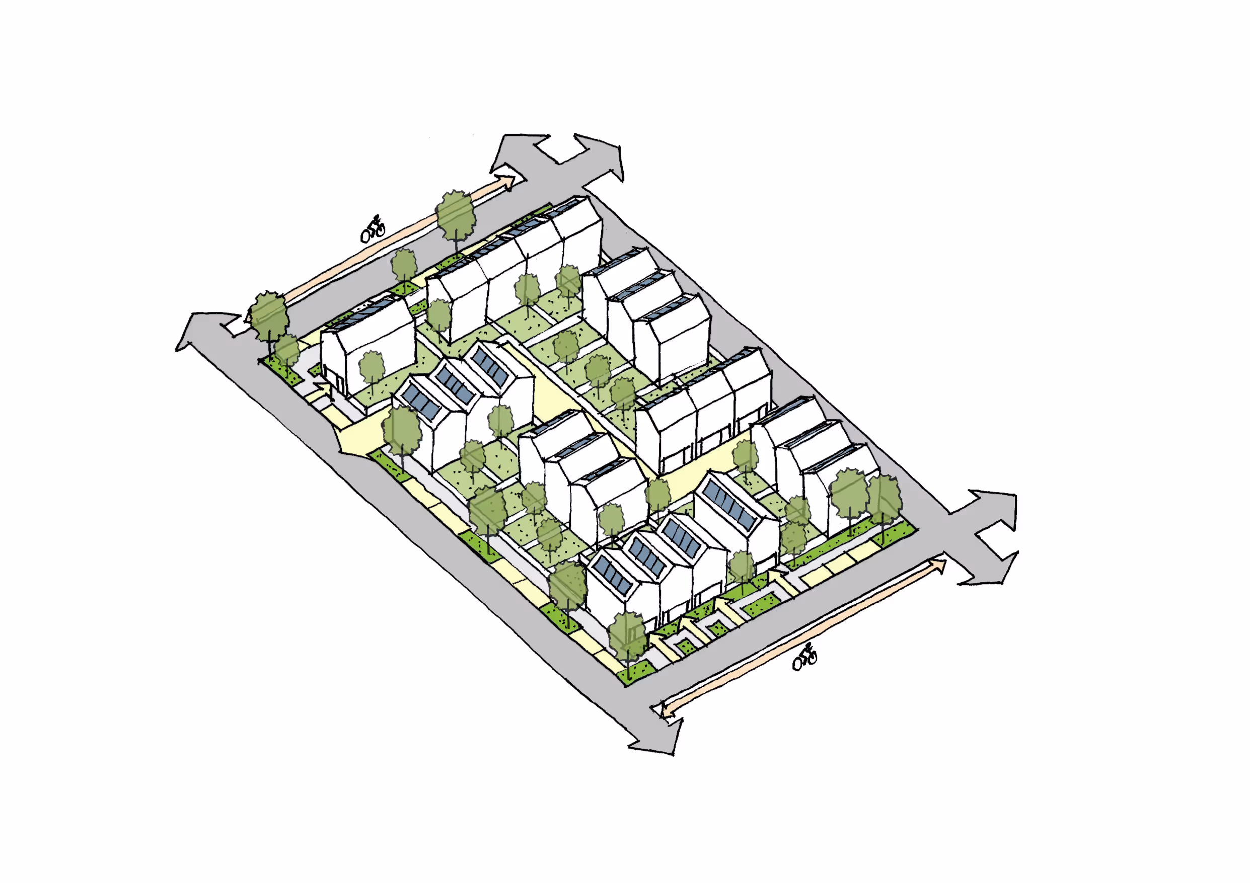
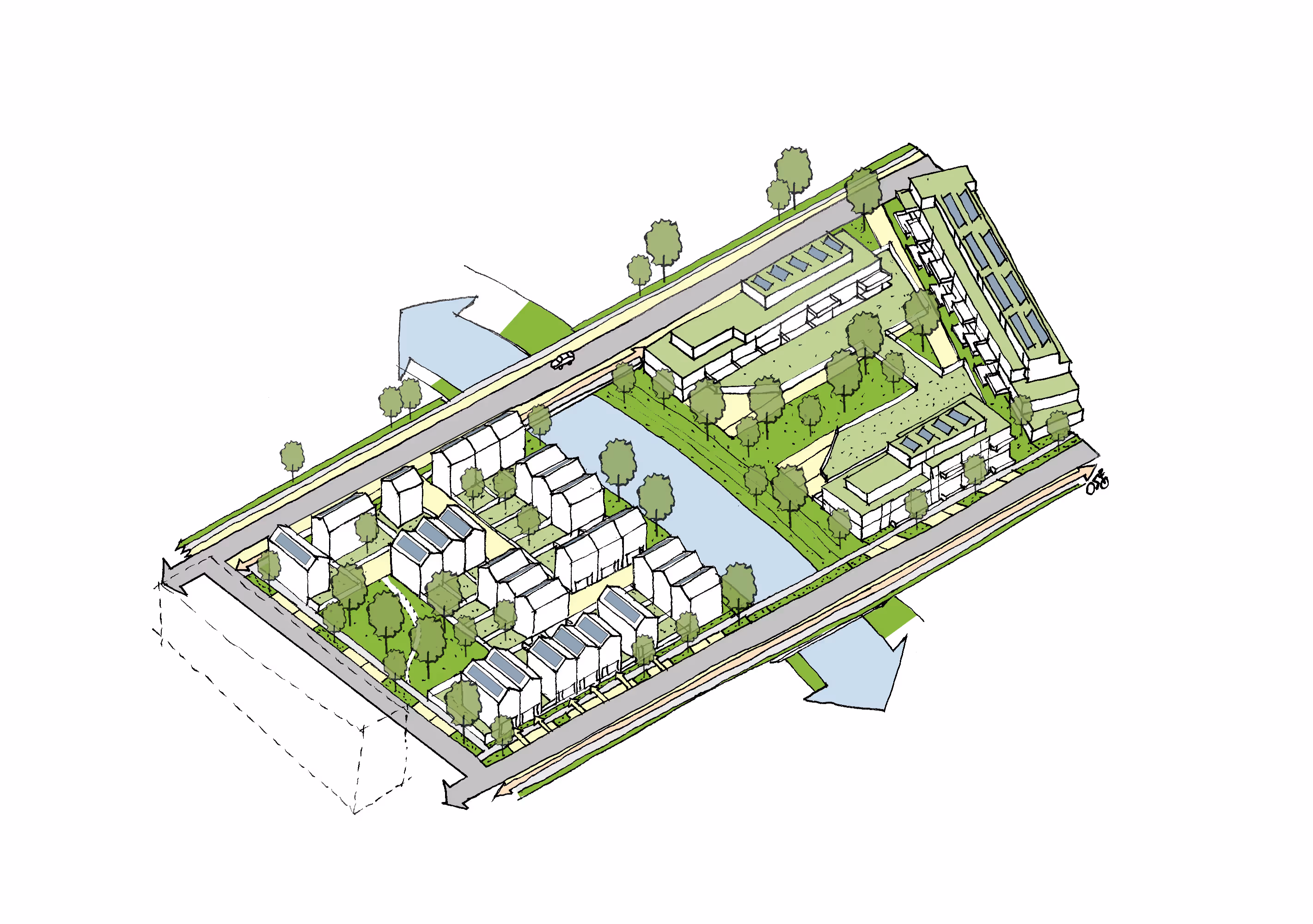
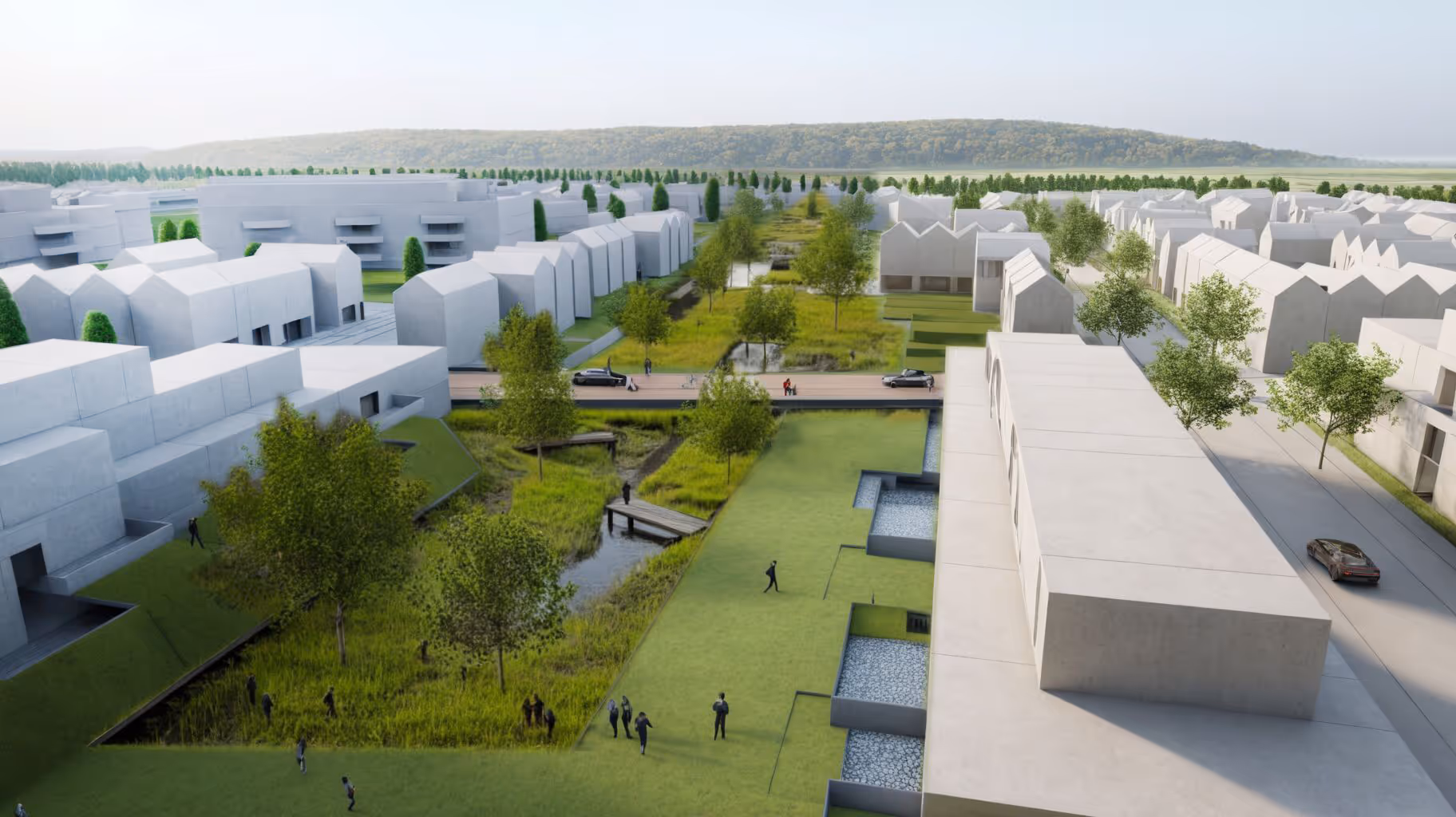
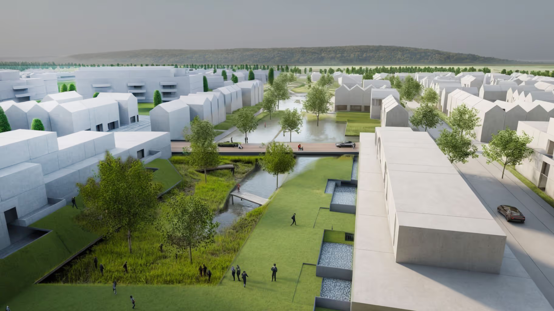
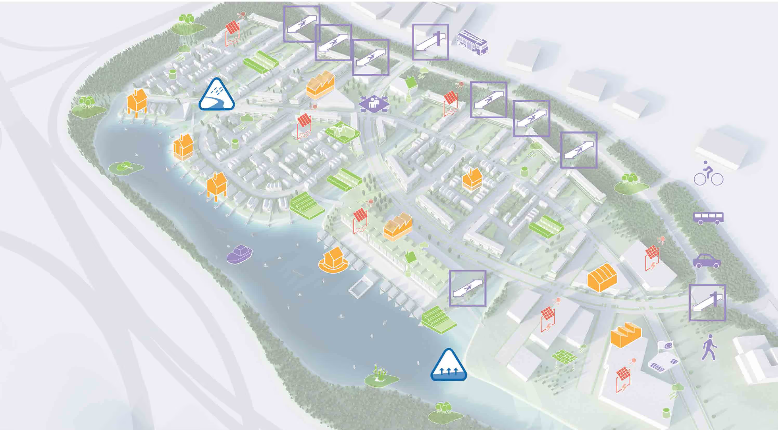
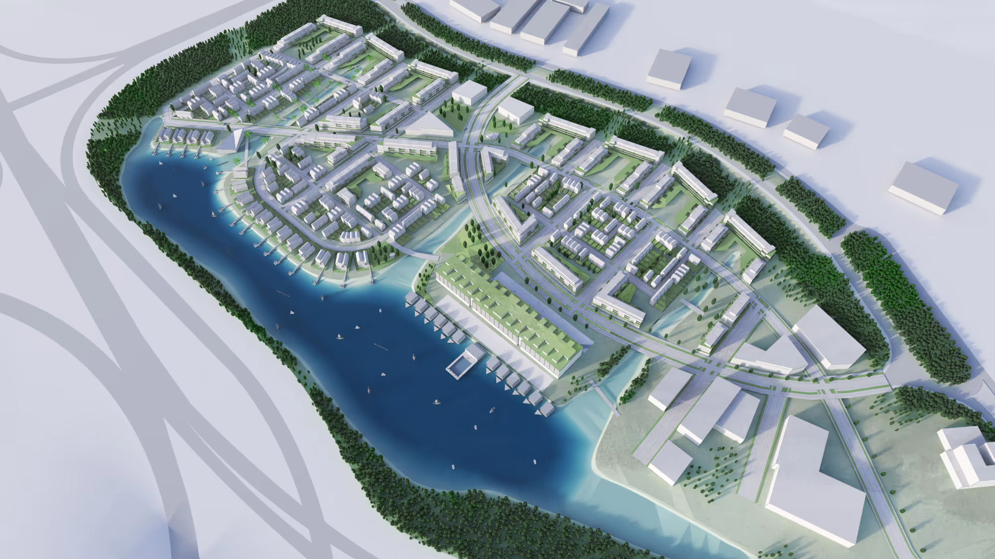
Using the principles of the award-winning LifE (Long-Term Initiative for Flood Risk Environments) project, originally developed for the UK Government’s DEFRA, we have developed the masterplan for the Lakeside redevelopment in Portsmouth.

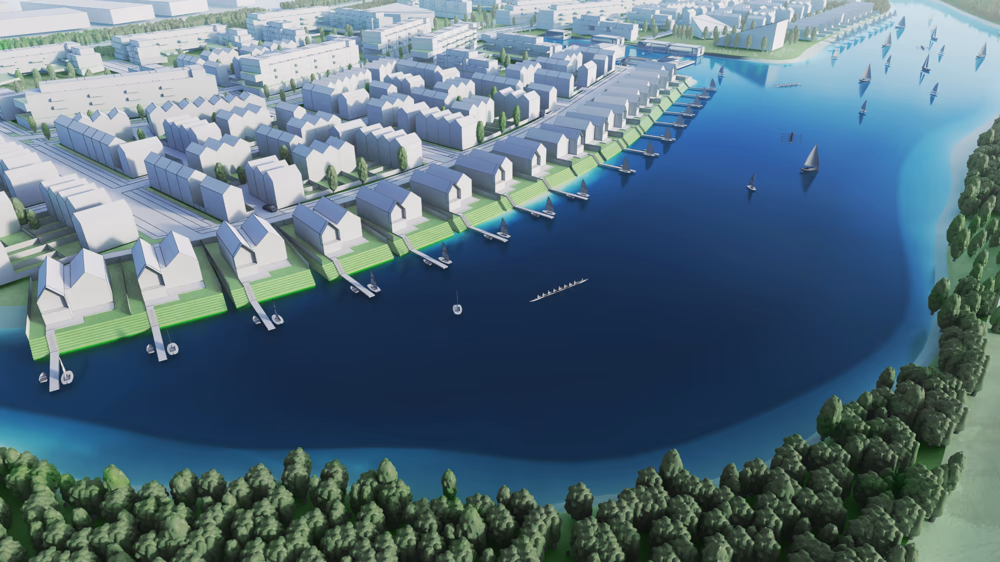
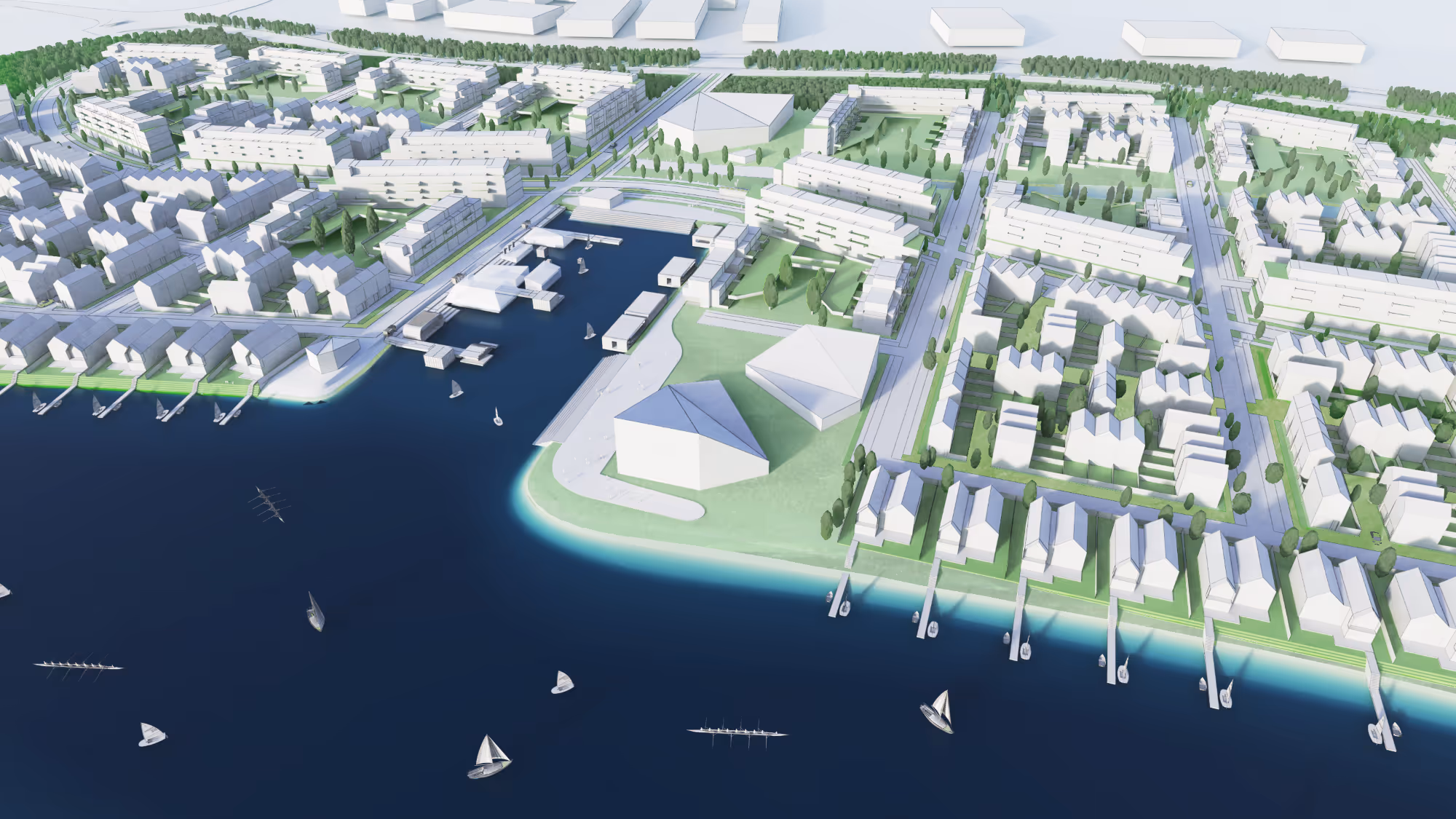
The 50-hectare site was once home to IBM’s 1980 business park and sits within the Solent floodplain, being only 5km from the city centre.

This project aims to transform the flood-prone area into a residential-led, mixed-use community that anticipates sea level rise and climate change.

A scheme that positions water, landscape and resilience at the heart of its design, accommodating 1,500 homes with associated civic squares, parks, and public amenities.

Process

BACA's integrated planning process began with a feasibility study assessing flood vulnerability, transport links, and potential for adaptive growth.

Using the LifE principles, the masterplan organises the site into safe development zones while ensuring continuity of daily life even during floods.

The strategy combines place making and flood management, introducing “swale corridors” that channel surface water, act as Sustainable Urban Drainage Systems (SuDS), and create landscape parks at the centre of the development.

These corridors divide the site into four character zones: business, housing, mixed-use, and the retained IBM Building 1000. Elevated roads and safe access routes are incorporated to maintain resilience during extreme weather.

Green infrastructure is prioritised over hard engineering, integrating ecology, recreation, and water management into the site’s structure.

Site development plan showing phases 1 to 4 within a designated area for development, proposed and existing vehicular access, possible pedestrian accesses, water features, and green buffer zones around the site.
Colored site plan of a residential area with roads, buildings, green spaces, and water bodies, outlined by a red dashed line.
Color-coded neighborhood master plan showing residential blocks, green spaces, roads, and water bodies outlined with trees and pathways.
Isometric sketch of a mixed-use urban neighborhood with residential buildings, green roofs, trees, pathways, waterfront docks, and bike lanes.
Isometric sketch of a residential block with modern houses, green yards, trees, and bike lanes along surrounding roads.
Isometric site plan sketch showing residential buildings, green spaces with trees, a water channel, roads with directional arrows, and pathways.
3D rendering of a waterfront neighborhood with houses, docks, boats, and a tree-lined shore.
3D aerial rendering of a waterfront urban development with residential buildings, green spaces, piers, and sailboats on the water.

Architecture

The plan reimagines the existing IBM Building 1000 as the neighbourhood’s civic landmark through retrofitting, recladding, and the addition of penthouses facing the lake.

The lake itself becomes the focal point, hosting leisure activities such as sailing, kayaking, and canoeing, supported by a new clubhouse and a mix of static and floating homes along its edge.

Housing typologies are distributed according to flood-risk zones: floating homes in high-risk (Zone 3b) areas, amphibious and resilient homes in moderate-risk zones, and traditional homes on higher ground.

The architecture and urban layout promote active streets, appropriate densities, and low-carbon living, with sustainable transport options like shuttle services, cycling routes, and electric charging points.

This masterplan demonstrates how making space for water can create a safe, attractive, and climate-adaptive community, offering a model for future flood-resilient urban design.

Aerial view of a modern white residential neighborhood with green spaces, trees, and water features integrated into the urban design.
A modern residential neighborhood with white buildings, green spaces, trees, water channels, and people walking along paths and bridges.
Aerial illustration of a coastal urban area with colored icons representing houses, factories, green spaces, solar panels, pedestrian and bicycle paths, and public transportation stops along waterways.
Aerial view of a modern coastal urban development with lakes, green spaces, residential buildings, and roads.